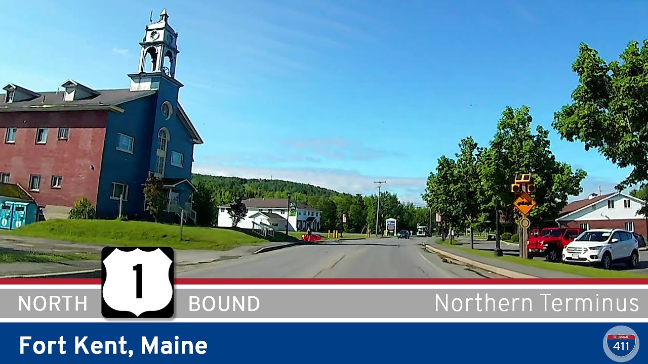
Join us as we travel the very top of U.S. Highway 1, right at the edge of the United States in Fort Kent, Maine. This short but symbolic stretch runs just about a mile, yet it represents the culmination of one of America’s most iconic highways — stretching all the way south to Key West, Florida, thousands of miles away. Today, we’ll experience the quiet charm of Fort Kent and the international connection it holds at the U.S.-Canada border.
We begin our brief journey where U.S. Route 1 intersects with Maine State Route 161 in the heart of Fort Kent. This small town is known as the northern gateway to the U.S., nestled along the banks of the Fish River and the Saint John River. Right after pulling onto U.S. 1, we cross the Fish River on a modest bridge — a crossing that gives us a glimpse of the river’s tranquil flow, a favorite spot for local fishing and canoeing when the weather allows. On our left, we soon pass the northern end of Maine State Route 11, another important route threading through Maine’s vast northern forests.
A few blocks further, the road guides us toward the iconic Clair-Fort Kent International Bridge. This bridge spans the Saint John River and connects Fort Kent directly with Clair, New Brunswick, Canada. For travelers, this spot is both a literal and symbolic threshold — the northern end of a highway that traces the East Coast all the way down through bustling cities, quiet coastal towns, and subtropical keys. Standing here, you’re closer to Montreal than Boston, and the Canadian influence is palpable in the bilingual signs and the easy cross-border flow.
While it’s a short drive, there’s a lot to see in Fort Kent if you’re making the trip. Consider stopping at the Fort Kent Blockhouse, a historic fortification from the Aroostook War era, located just a short walk from the bridge. In winter, Fort Kent transforms into a hub for snowmobiling and hosts world-class biathlon events at the 10th Mountain Ski Center. The surrounding woods and riverbanks offer beautiful views any time of year, and the small downtown is dotted with local cafés and shops that feel worlds away from the busy interstates down south.
As we approach the Clair-Fort Kent Bridge, the official northern terminus of U.S. Route 1 comes into view. There’s a simple but proud sign marking this spot, popular with road-trip enthusiasts who want that “End of U.S. Route 1” photo for their collection. Crossing the bridge means you’ll enter Canada — so don’t forget your passport if you plan to continue your journey north into New Brunswick.
Whether you’re here for the history, the quiet river scenery, or just to stand at the top end of an American legend, this short mile in Fort Kent is a must-see for highway fans. From here, U.S. Route 1 beckons you southward — through Maine’s forests and coastal towns, down New England’s storied shoreline, through big cities like Boston, New York, and Miami, and all the way to mile marker zero in the Florida Keys.
🗺️ Route Map
0 Comments