
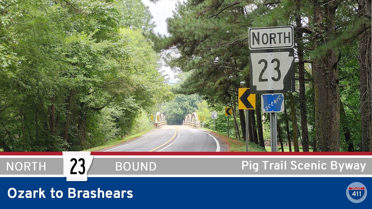
Arkansas Highway 23 between Brashears and Ozark is more than just a road—it’s a journey into the soul of the Ozarks. This 24-mile stretch, known fondly as the Pig Trail Scenic Byway, has earned its reputation as one of the most beautiful drives in the South. Whether you’re behind the wheel of a motorcycle or a car, this segment of Highway 23 showcases a perfect blend of natural beauty, twisty mountain curves, and rural Arkansas charm.
We begin our journey in the small community of Brashears, where Highway 23 splits off from its brief concurrency with AR-16. At this point, the road is relatively tame, offering a few straight stretches that act as a warm-up for what lies ahead. It doesn’t take long, however, before the curves kick in as we make our way south toward Mulberry Mountain, a popular campground and event venue that hosts gatherings like the Mulberry Mountain Music Festival. As we dive deeper into the Ozark-St. Francis National Forest, the Pig Trail begins to live up to its reputation—hairpin turns, shaded tree tunnels, and sweeping elevation changes define this section of the drive.

One of the key waypoints along this route is Cass, a tiny mountain community just south of the AR-215 junction. Here, we pass the Job Corps Center, a quiet but active part of the local fabric, and continue down into the Mulberry River valley. The river crossing at Turner Bend is a scenic highlight, with a historic general store and outfitter that serves as a favorite stop for paddlers and travelers alike. The bridge itself offers a moment of visual clarity—lush riverbanks and water that winds like the road you’re traveling on.
After Turner Bend, the climb begins again. We snake through a series of tight switchbacks that test both driver focus and passenger nerves before gradually leveling out. The landscape transitions from rugged mountain terrain to the softer contours of the Arkansas River Valley as we approach the small community of White Oak. Here, we intersect AR-352, the final spur before the Pig Trail straightens out and settles into its last leg.
The final few miles are gentler, marked by open pastures and fewer curves as we roll closer to Ozark. Just before reaching Interstate 40, we conclude our journey at a local fuel stop—a fitting endpoint where travelers can fill up and reflect on one of Arkansas’s most storied backroads.
🗺️ Route Map
0 Comments