![Interstate 57: Sikeston, Missouri to Cairo, Illinois | Real Roads, Real Drives [Revisited]](https://openroadarchive.com/wp-content/cache/flying-press/c30d974de1e30b542bb6716541aef436.jpg)
Drive America’s Highways for 22 miles northbound along Interstate 57 from I-55 in Sikeston to the Illinois state line, a smooth delta-country run framed by farmland, open skies, and the quiet approach toward the Mississippi and Ohio River region.
Take a measured ride through the northern edge of Missouri’s Bootheel as we head northbound on Interstate 57 from Sikeston toward Cairo, following a short but quietly important 22-mile stretch that eases us out of the Mississippi Delta lowlands and toward one of the Midwest’s most storied river junctions. This is not a flashy drive, and it does not try to be. Instead, it offers a calm, efficient glide through working farmland and wide-open sky, where the interstate’s purpose is clarity and connection rather than spectacle.
We begin at the broad interchange where Interstate 57 departs from Interstate 55 on the eastern edge of Sikeston. The geometry here is deliberate and spacious, designed for long-haul traffic moving cleanly between north–south corridors. As we settle into I-57’s northbound lanes, the road immediately establishes its character: straight, flat, and confident. The Bootheel landscape spreads out on either side in long horizontal lines—row crops, drainage ditches, shelterbelts of trees, and the occasional grain facility rising just enough to punctuate the horizon. This is delta country shaped by agriculture and water management, and the highway fits neatly into that logic.
As the miles pass, interchanges appear sparingly, serving rural routes that thread back toward small towns and farmsteads rather than dense development. Traffic tends to be light and purposeful here—regional commuters, agricultural haulers, and cross-country travelers using I-57 as a quieter alternative to busier river routes. The road surface is smooth and uninterrupted, with wide shoulders and clear sightlines reinforcing the sense that this corridor was built to move people efficiently through the landscape, not to slow them down with unnecessary complexity. We are never far from history, though; older U.S. highways once carried this same north–south movement, long before the interstate formalized it.
The farther north we travel, the more the surroundings subtly shift. Tree lines become slightly more frequent, hinting at the river systems that dominate this corner of the Midwest. The flatness remains, but the land begins to feel transitional—less purely delta farmland and more a threshold between regions. There is a quiet anticipation in this stretch, a sense that something larger lies just beyond the next few miles. That feeling is reinforced by the thinning traffic and the openness of the sky, which seems to widen as the state line approaches.
Near the Missouri–Illinois border, Interstate 57 carries us toward the greater river landscape defined by the meeting of the Mississippi River and the Ohio River. While this particular segment does not linger on the bridges themselves, the presence of those rivers shapes everything around us—from the soil beneath the fields to the strategic importance of the corridor we are traveling. Crossing into Illinois near Cairo marks more than a simple change of state signage; it signals entry into a region where waterways, rail lines, and highways have converged for centuries, making this a natural crossroads of American movement and commerce.
As the Missouri portion of I-57 comes to a close, the drive leaves us with an appreciation for understated infrastructure done well. There are no dramatic elevation changes or sweeping curves here, but there is a steady rhythm that reflects the land it serves. This stretch of Interstate 57 functions as a clean seam between regions, carrying us smoothly from the Bootheel’s agricultural grid toward the historic river confluence beyond. It is a reminder that some of America’s most essential highways reveal their value not through spectacle, but through reliability—quietly stitching together landscapes, communities, and journeys one mile at a time.
Interstate 57 begins its journey at the interchange with I-55 on the eastern edge of Sikeston, carving a direct path toward Illinois through the flat, agricultural landscape of Missouri’s Bootheel. This revisited segment captures the highway as it moves past the familiar junctions and rural access points that have long connected the region’s small communities with the larger corridors of the Midwest. The road is characteristically straight and steady here, offering a calm, uninterrupted drive as it parallels the long-established U.S. 60/62 corridors that historically served the area. Modern interchanges and wide shoulders keep the route efficient, while the surrounding scenery — fields, tree lines, and distant grain facilities — reflects the working rhythm of southeast Missouri.
As the Missouri portion of I-57 comes to a close, the drive leaves us with an appreciation for understated infrastructure done well. There are no dramatic elevation changes or sweeping curves here, just a steady rhythm that mirrors the land it serves. This stretch of Interstate 57 functions as a clean seam between regions, carrying us smoothly from the Bootheel’s agricultural grid toward the historic river confluence beyond. Despite being a major interstate, this route has more nearby attractions than you’d think, making it a quietly rewarding segment as we continue north through the heart of the Midwest.
🎵 Music: Track List
Music from this video may be available for purchase at https://theopenroadcollective.com
🗺️ Route Map
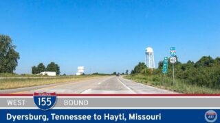
![Interstate 155: Dyersburg, Tennessee to Hayti, Missouri [Revisited]](https://openroadarchive.com/wp-content/uploads/2025/06/dcbfmcfwp-wmaxresdefault.jpg)
0 Comments